
2nd November 2023
Last modified on November 3rd, 2023
There has already been some snow but in reality it has been dustings. This is the real deal with over 50cm forecast. UPDATED
A major storm is now hitting the Alps after some decent snowfall already this week.
It is being described as ‘the start of a major storm cycle across the Alps that will last through the weekend and maybe beyond’.
By the time the storm passes at the weekend high altitude areas may have seen over half a metre.
Perhaps more in places.
It is falling lower down too.
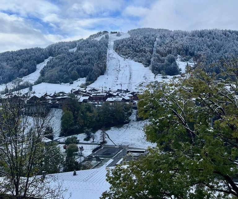
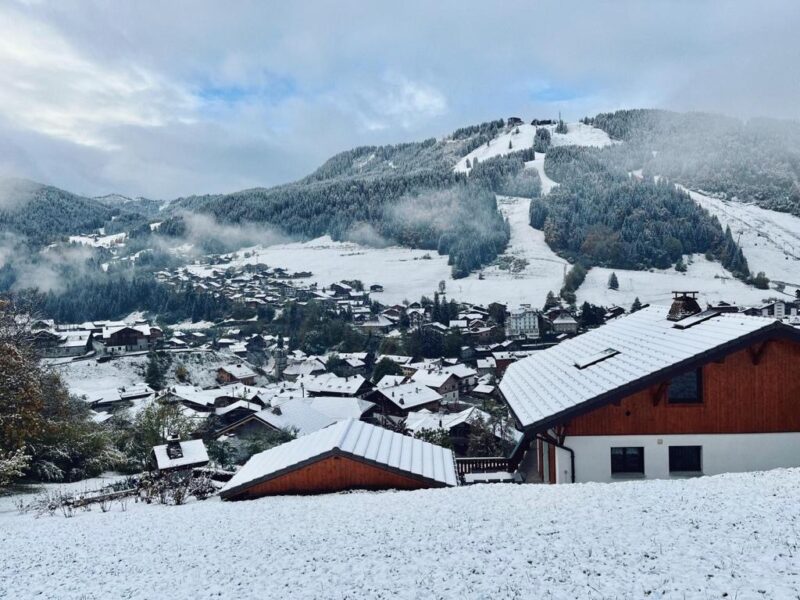
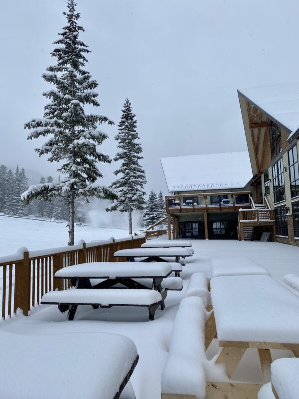
Here are the latest images we have that come from Morzine in France.
Morzine, France. Image c/o Morzine Tourist Office.
Morzine, France. Image c/o Morzine Tourist Office.
Morzine, France. Image c/o Morzine Tourist Office.
Meanwhile at altitude:
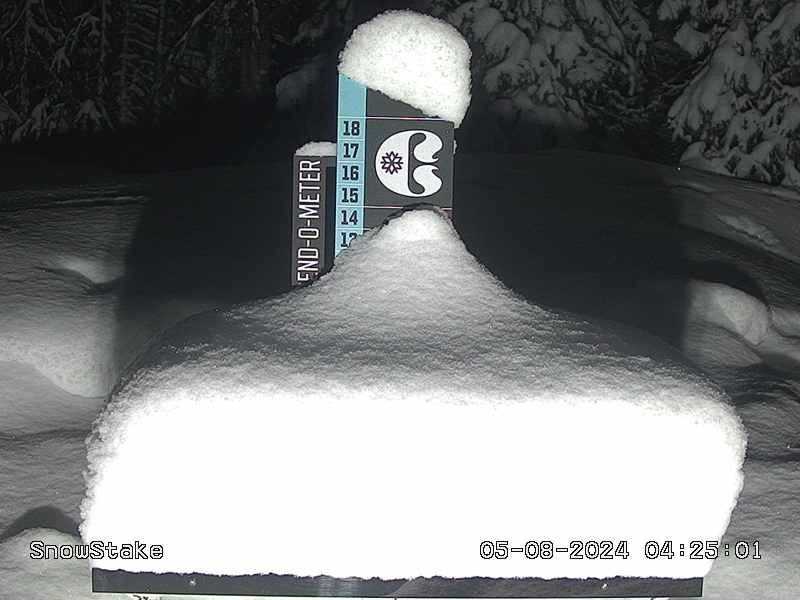
Significant snow to increasingly low levels for many parts of the Alps today. This is #Tignes Le Lac, 2100m: https://t.co/PGoKdcOhGN pic.twitter.com/wyFFO5MZLi
— weathertoski (@weathertoski) November 2, 2023
Up to 30cm has already fallen at altitude in Austria with the open glacier resorts benefiting.
“The weather in the Alps remains very unsettled, with a new storm crossing the Alps from west to east which will deliver significant snow at altitude to many regions,” said Fraser Wilkin from Weathertoski.co.uk on Thursday 2nd November.
“This storm will particularly benefit the higher resorts of the French Alps, including Tignes, Val d’Isère, Val Thorens and Les 2 Alpes, where 30-40cm is expected above 2,300m by the end of tonight with a rain/snow limit starting at around 2300m but falling to 1,000m or so during the early hours of Friday.
“The second main area to benefit will be a swathe of the central-southern Alps including resorts such as St Moritz, Livigno, Passo Tonale and Obergurgl.
…ora sembra intenzionata più seriamente, ciao a tutti, a più tardi👋#livigno #tuttolivigno #snowing #snow #neve pic.twitter.com/UnjWrkuP28
— Tutto Livigno 🇮🇹 (@TuttoLivigno) November 2, 2023
“These areas should also see at least 40cm, above 2,300m, later today and overnight but, due to milder air hanging on a bit longer, it will be tomorrow morning before we see the snow-line finally dip towards 1,200m.
“Most other parts of the Alps will also see a significant fall of snow at altitude over the next 24 hours, with typically 20-40cm above 2,300m, though the far south-west (e.g. Isola 2000) will only see a few centimetres at best.
“The rain/snow limit will remain highest for longest in the far south-east (Dolomites) but, even here, there will be a decent fall of snow higher up tonight.
“After a relative reprieve on Friday, a significant new storm is then set to arrive from the west on Sunday.”
Do check out Weathertoski.co.uk for the very latest.
Kitzsteinhorn above Kaprun in Austria is planning to open on Friday 3rd.
We list all the resorts currently open at the end of this article, though many are temporarily closed as the storm hits.
Things are looking good in Verbier in Switzerland that is set to open shortly.
According to our friends in Verbier, who know about these things, the Lac des Vaux area may open sooner rather than later.
There were rumours of this weekend, but they have been quashed by the resort.
We’ll let you know, but the smart money is on next weekend if the storm delivers.
In Switzerland Glacier 300o is set to open on Saturday 4th November.
Now we should stress that it is early November and it will make little difference to the snowpack for the approaching winter in the vast majority of resorts.
It will help the glaciers resorts that are currently open, over a dozen of them.
We’re delighted here at PlanetSKI as we’re hoping to visit a few of the glacier resorts in the Tirol later this month.
Watch this space.
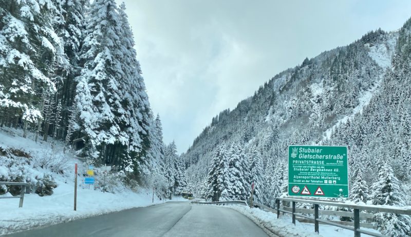
Stubai, Tirol. Image © PlanetSKI
Plus is will help some ski resorts will be looking to open some small areas shortly.
It will also make a difference at altitude in the high alpine ski resorts:
Val d’Isère/Tignes & Val Thorens in FranceCervinia in ItalyObergurgl & Ischgl in Austria
“Some higher non-glacial terrain should also now have secured a lasting base,” added Fraser Wilkin.
It also gets us all in the mood for winter and some people will now be thinking more about the season ahead, and booking a ski trip.
There is plenty of availability at Xmas with some good deals as it has not sold well so far.
Ski companies report an increase an interest and some have extended their special offers.
“Good to see the snow falling in the Alps,” said our good friend Craig Burton from Ski Solutions to PlanetSKI.
See here for our November Deals and Discounts page that has further offers.
We have been following the autumn snowfalls here on PlanetSKI:
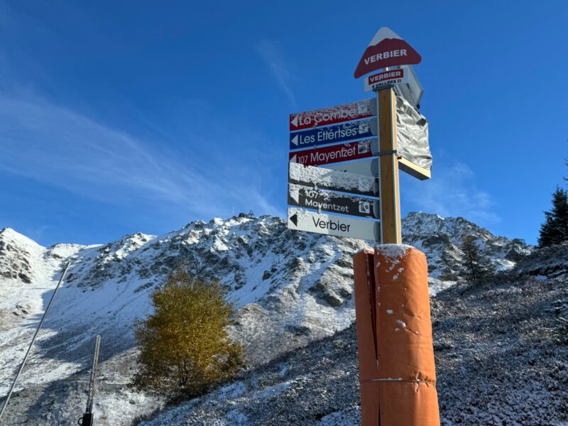
Verbier. Image c/o Steve Sparks.
Lets not forget the snow elsewhere in Europe.
Skiing is set to get underway in Norway this weekend:
We visited Norefjell last winter on a rail trip round a bunch of ski resorts in Norway:
Here are the resorts in Europe offering skiing at the moment (weather permitting):
Austria:
Kaunertal, Soelden, Hintertux, Pitztal & Stubai.
Finland:
Levi and Ruka.
Italy:
Passo Stelvio & Cervinia.
Switzerland:
Saas-Fee & Zermatt.
There have also been heavy autumn snowfalls in North America with resorts opening some areas in Canada and the USA.
See here for our full report on the action across The Pond:
Mt Norquay, Alberta, Canada.
Here at PlanetSKI we will be updating in real-time over the next few days as the snow falls in Europe.
Do check back…
![]()


